NAVIONICS 010C136830 Plus Regions North Lake Charts on SD/MSD,Black
reset
SKU: 010C136830 F30472
Compatible With Chart Plotters Detailed Coverage Of U.S. North Lakes/ Rivers And Coastal Region Code: NAUS005R On SD/ Micro-SD Card With Sonar
Show moreAvailable: In stock
Compatible With Chart Plotters
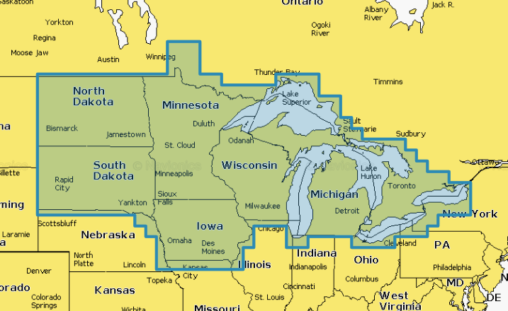
Detailed Coverage Of U.S. North Lakes/ Rivers And Coastal
Region Code: NAUS005R
On SD/ Micro-SD Card
With Sonar Chart™ Live Mapping/ High-Resolution Relief Shading/ Advanced Map Options/ Dock-To Dock Route Guidance/ Daily Updates/ Plotter Sync/ Community Edits
Max detailed charts for cruising, fishing and sailing.
Get more than 7,400 lakes in IA, MI, MN, ND, SD, and WI, plus all of Lake of the Woods, Rainy Lake and US waters of the regions Great Lakes.
Includes Nautical Chart, a robust chart resource trusted by boaters worldwide.
Includes SonarChartTM 1 foot HD bathymetry map that reflects ever changing conditions, and Community Edits, valuable local information added by millions of Navionics Boating app users.
Get the most current charts every day with daily updates for one year.
Copyright Ⓒ 2002-24 The Twister Group.